
About Greybox
Welcome to Greybox.
We turn precision data into actionable insight — helping our clients see, build and manage their spaces with confidence.
01 — Our story
Founded on a simple conviction.
The built environment is moving from static assets to intelligent systems — and the organisations who win in this transition will be the ones with high-quality digital data underneath them.
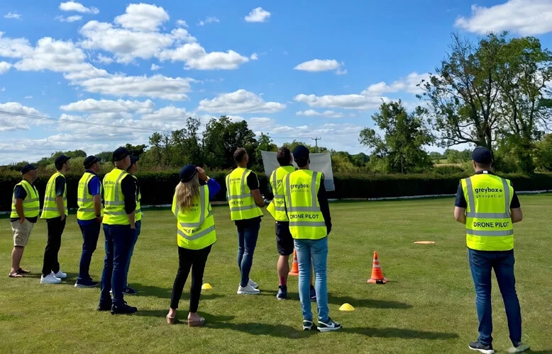
We are a UK-based team of construction professionals, BSI-certified BIM specialists and Civil Aviation Authority (CAA) certified UAV operators. Our work spans digital construction, reality capture, UAV survey and digital transformation advisory — delivered across critical infrastructure, defence, public sector and commercial property portfolios.
What sets us apart is the combination of technical mastery and project delivery experience. We understand the ‘what’ of your work because we have lived it. We connect it to the ‘where’ with rigour you can audit.
02 — Vision, mission & values
The principles behind every deliverable.
To become the leading provider of asset intelligence — transforming data into meaningful solutions for a sustainable future.
We harness cutting-edge technology to transform spatial data into critical information and insight. Through advanced UAV operations, reality capture, asset identification and intelligent automation, we bridge the gap between raw data and strategic action.
Precision
Accurate, reliable and reproducible data to a measurable tolerance — every time.
Innovation
Embracing new technologies, workflows and ways of thinking to push what is possible.
Sustainability
Using digital data to reduce waste, optimise resources and support environmental objectives.
Integrity
Transparent, ethical and accountable in every dataset, deliverable and conversation.
Why Greybox
We understand the ‘what’ because we have lived it. We connect it to the ‘where’ with rigour you can audit.
Technical mastery — project delivery experience
03 — Our people
Meet the team behind Greybox.
Academic excellence, decades of practical delivery — and a single point of accountability on every project.

Jac Parry
DirectorJac brings extensive expertise in digital construction and geospatial intelligence, leading our strategic initiatives in BIM implementation and digital transformation. Specialising in ISO 19650 compliance and reality capture, Jac ensures clients receive cutting-edge solutions backed by rigorous technical knowledge.

Daniel Kent
DirectorDaniel holds an MSc in Construction Project Management and is a qualified BIM professional, with a background in Central Government and Defence FM project delivery. He leads our digital transformation and AI ideation for project and asset management workflows — bringing real-world benefits through AI, BIM, reality capture and UAV applications.

Andy Tiplady
DirectorAndy combines deep technical knowledge with extensive project delivery experience across asset-intensive sectors. His expertise in UAV operations and precision surveying drives our innovative approach to data capture — with a focus on data quality and regulatory compliance that delivers practical, actionable insight.

Tanya Parry
AccountantTanya is a highly experienced Management Accountant with over 10 years in the industry. She has played a key role in attracting multi-million pound investment for globally leading marine energy projects, and brings a broad commercial background from working with a major UK development company — with a passion for sustainability throughout.
04 — What sets us apart
The numbers that matter.
Faster capture
UAV survey versus traditional ground methods on comparable sites.
Point cloud density
Professional-grade LiDAR systems delivering millimetre-grade fidelity for asset modelling.
Compliant by default
BIM execution plans aligned to the UK BIM Framework on every engagement.
Digital delivery
Cloud-based handover — auditable and Golden Thread ready.
Reduced rework
Cutting the rework that stems from miscommunication and poor project data.
Coverage per day
Rapid, repeatable UAV coverage across large sites and portfolios.
05 — Sectors we serve
Trusted across asset-intensive sectors.
From critical national infrastructure to creative production — tailored digital solutions for the industries that depend on accurate data.
Critical Infrastructure
Energy & utilities · Telecommunications · Infrastructure development · Transport & aviation
Government & Defence
Defence estate · Central Government · Education & healthcare · Public sector property
Commercial & Industrial
Manufacturing · Commercial property · Agriculture & land management · Residential development
Creative & Leisure
TV & film production · Sports & leisure venues · Retail estates · Media & entertainment
In collaboration with












06 — Working with Greybox
How we work with you.
A five-stage process — senior-led at every step, from first conversation through to ongoing asset support.
Consultation
Understanding your requirements — technical, regulatory and commercial.
Solution design
Tailored methodology, deliverable schedule and quality plan agreed.
Project execution
Professional delivery with regular communication and quality checkpoints.
Data delivery
Comprehensive deliverables in your preferred formats — audit-ready.
Ongoing support
Continued assistance, follow-on capture and asset management services.
Ready to transform your project?
Let’s discuss how precision geospatial intelligence can deliver actionable insight for your organisation.