
Case studies
Outcomes our clients can measure.
Digital construction, reality capture, UAV survey and BIM expertise — delivering measurable results across defence, government, FM and commercial sectors.
Featured — Defence / CNI
Confined-Space UAV Infrastructure Survey.
Specialist drone inspection carried out within a restricted, enclosed infrastructure environment where traditional surveying posed safety, access and cost challenges.
-
Challenge
Hazardous spaces demanded a fully remote digital approach — no manned entry, no GPS, no light.
-
Solution
Confined-space UAV technology with high-resolution imagery, navigating in zero-light, zero-GPS conditions.
-
Result
Eliminated manned entry into hazardous spaces, delivered accurate condition data, and reduced downtime and safety risk.
Project showcase
How your data translates into measurable outcomes.
Aerial & Reality Capture — 3D
An integrated reality capture programme combining UAV topographical survey with terrestrial laser scanning. We produced a Gaussian-splat 3D model, a ground-level virtual tour, and full as-built CAD drawings of all properties alongside 3D models for future development.
Output: 2D + 3D drawings & models
Read the full case studyInvestigation & As-Built Drawings
Investigation works for a restaurant build in Mayfair, examining legacy access points adjacent to the premises. We surveyed and recorded existing layouts, then updated the as-built drawings to reflect the findings — a reliable basis for development decisions.
Output: 2D + 360° virtual tour
Read the full case studyInspection Survey — Virtual Record
A full internal and external condition assessment, reported through a bespoke virtual platform shared with chartered surveyors. Every defect tagged in a navigable model — a single, reliable source for remediation and ongoing decision-making.
Output: 360° virtual condition tour
Read the full case studyHow we deliver
Innovative solutions. Precision data. Decisive action.
UK-wide reality capture — digital construction — aerial survey
Defence & infrastructure
Critical environments, audited data.
Confined-Space UAV Survey
Specialist drone inspection in enclosed infrastructure with zero-light, zero-GPS navigation — eliminating manned entry into hazardous spaces.
Multi-Building Estate Reality Capture
Full internal and external terrestrial laser scanning with point-cloud generation — modernised estate data suitable for planning and compliance.
Integrated Scan & Drone Survey
Combined drone survey and terrestrial scanning for comprehensive condition data — a single source of truth for multiple stakeholders.
Digital transformation
Capability that lasts.
Virtual Estate & Digital Twin Demonstrator
A 3D navigable environment with high-fidelity visualisation — a tool for early design conversations that lets non-technical users and leadership visualise complex spaces.
Multi-Site Aerial Survey Programme
A standardised UAV survey methodology across a large property portfolio — reducing reliance on external providers and creating consistent year-on-year datasets.
Digital Toolkit & BIM Framework
ISO-aligned information management templates, CDE governance and scan-to-BIM workflows for consistent digital delivery.
BIM Advisory for Programmes
Digital maturity uplift and BIM guidance for complex projects — improved capability across teams and stronger competitive positioning.
Drone Pilot Training Programme
Structured internal UAV training and accreditation — a significant reduction in external survey spend and a broader pool of qualified operators.
FM & capability building
A single source of truth for estate information.
Estate Digitalisation
Digital modernisation with corrected building plans and unified layouts — operationally useful 2D and 3D outputs, enhanced compliance accuracy, and a single source of truth for estate information.
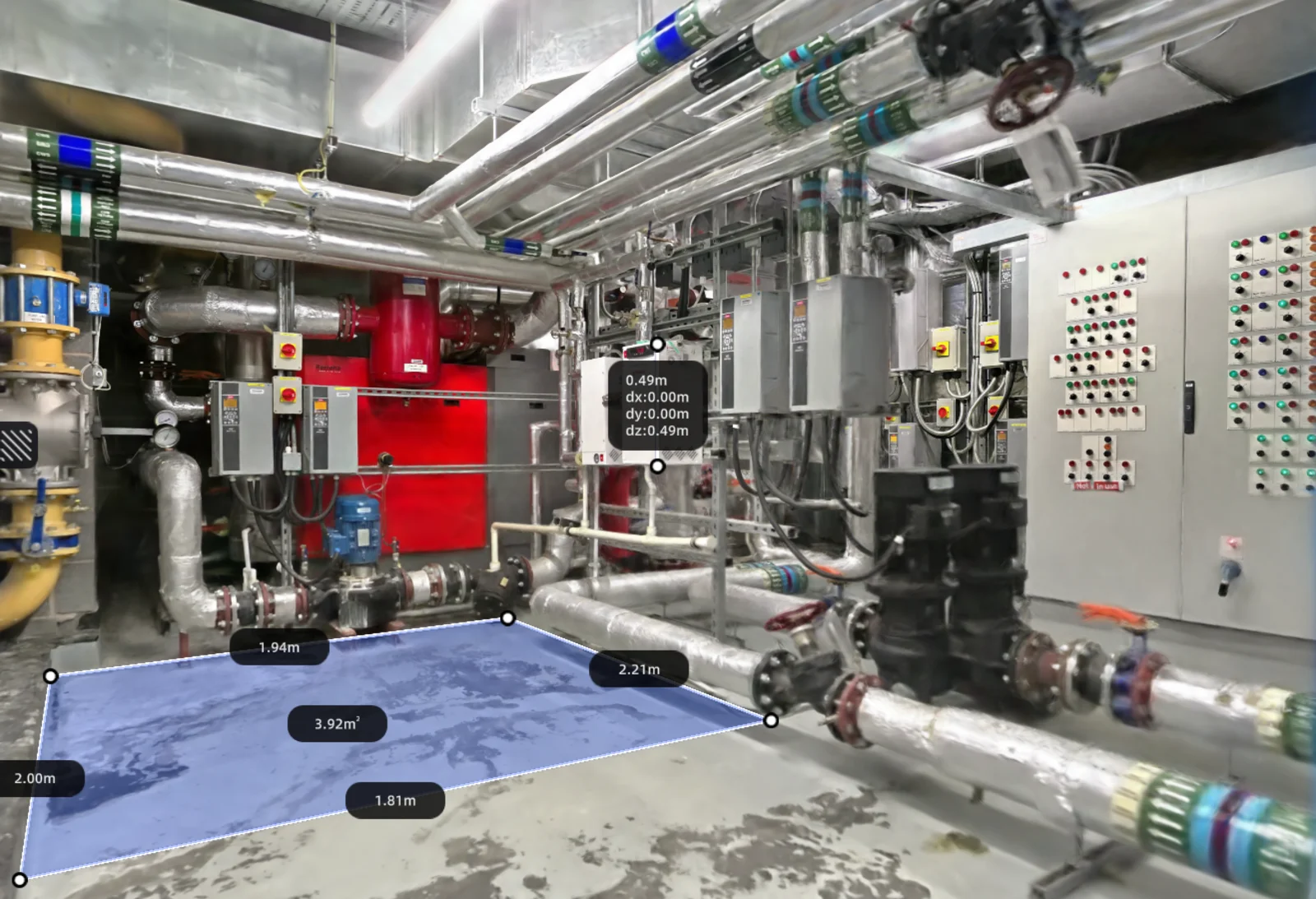
Plant Room Condition Capture
Detailed capture of plant and equipment with dimensioned, navigable records — supporting maintenance planning, asset registers and compliance evidence without repeat site visits.
Your project could be next.
Let us help you achieve similar results with proven geospatial expertise and innovative delivery.