Case study — Industrial
Aerial & Reality Capture — 3D.
An integrated reality capture programme for an infrastructure client — from UAV topographical survey to as-built CAD drawings and a navigable 3D model.
The challenge
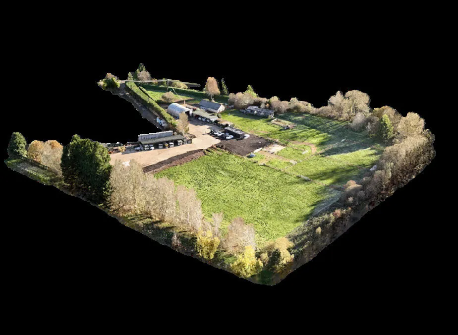
The client needed a complete, current picture of a busy 21,500 m² industrial yard — buildings, hardstanding, plant and terrain — to support planning and future development. Existing records were fragmented and out of date, and a conventional measured survey would have meant prolonged disruption to a working site.
Our approach
We designed an integrated capture programme combining a UAV topographical survey with terrestrial laser scanning (LiDAR). Flying the site gave rapid, complete coverage of roofs, terrain and hard-to-reach areas; ground-based scanning added millimetre-grade detail around buildings and plant. The two datasets were fused into a single, geo-referenced point cloud.
What we delivered
- A Gaussian-splat 3D model of the entire site, navigable in a browser
- A ground-level virtual tour for remote familiarisation
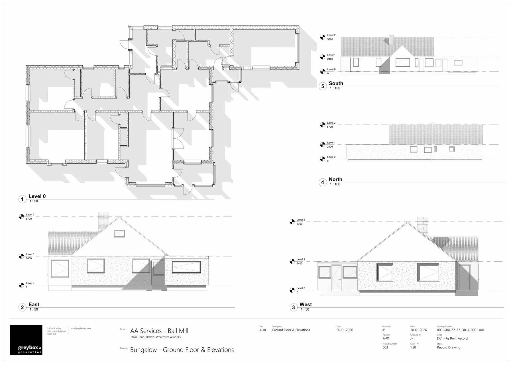
- Full as-built CAD drawings of all properties — plans and elevations
- 3D models structured for future development work
The outcome
The client now holds a single, reliable digital record of the site: drawings for immediate planning use, and 3D assets ready for design development. Capture was completed with minimal disruption to site operations, and the datasets are structured so future surveys can be compared year on year.
Need a site captured like this?
One conversation is enough to scope the right combination of aerial and terrestrial capture for your site.